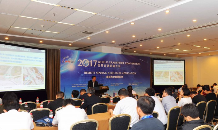
On the afternoon of June 6,experts and scholars gathered together to discuss the practical application of remote sensing technology in transportation and exchanged their experiences at sub-forum on maritime remote sensing - remote sensing and large data application for the World Transport Convention (WTC).The forum is sponsored by China Institute of Navigation(CIN), hosted by Maritime Remote Sensing Committee(MRSC) and co-sponsored by China Transport Telecommunication & Information Center(CTTIC).
Remote sensing image was widely applied in the field of transportation, including remote sensing for transportation survey, remote sensing image map and electronic map creating, interpretation for highway engineering geology remote sensing, traffic safety and disaster relief, rapid investigation for traffic accident scene, traffic demand forecast, video identification for vehicle and license plate, etc..The payload of radar satellite is Synthetic Aperture Radar(SAR), which actively utilizes the large bandwidth pulse compression in range direction and synthetic aperture techniques in azimuth direction to image the earth in all-weather and all-time conditions. As radar satellite is characterized by all-time, all-weather, high-resolution and high precision, it can greatly enhance and improve the application of space-based observation inthe field of transportation by docking radar satellite with intelligent transportation.
The application of SAR satellite intelligent transportation mainly covered electronic channel mapping, ship intelligent identification, coastline survey and island reef monitoring, maritime traffic situation intelligent sensing, intelligent monitoring of navigation environment, intelligent monitoring of port transportation facilities deformation, intelligent early warning of sea ice disaster, said Chen Junli, chief designer of satellite at Shanghai Academy of Spaceflight Technology (SAST). For example, almost 46 cities across the country are subsiding, and since 1921, land has subsided about 183 centimeters in Shanghai, which isamong cities that most affected by land subsidence. Differential interferometric SAR(DINSAR) can extract information on deformation of transportation facilities like highway, railway, bridge, airport and surrounding ground settlement; it also provides good maintenance for transportation facilities and ensures transportation safety.High-resolution radar images can identify roads, waterways, bridges and other transportation facilities, and conduct post-disaster emergency evaluation of damage to transportation facilities in geological disasters. INSAR can acquire global seamless high-precision DEM; it provides base maps for transportation data and intelligent transportation appliances. Based on the penetrating abilities of low frequency radar, it is possible to observe the distribution of subsurface features, hydrothermal environment and geological structure in observed area, and provides the design basis for road planning and construction.
It has practical referential meaning to military strategy and action for providing transportation geospatial information, transportation facilities basic data and transportation operating information, said Lauren, director of the Institute of Transportation and Remote Sensing in CTTIC. Based on The Demonstration Project of Civil Military Integration in the Field of Highway Transportation and other major projects, CTTIC closely combined with the demand of transportation operations and focused on the following aspects:rural road investigation and verification and key transportation project supervision; planning and adjustment for national and provincial trunk; deformation monitoring for transportation facilities; electronic sand table construction for transportation precision poverty alleviation; verification and docking for highway project; transportation mapping and monitoring and evaluation of highway water ruins.
Radar satellite is an indispensable tool for satellite to observe the earth and is essential to the development of economy and national defense. Radar satellite is characterized by all-time, all-weather, high-resolution and high precision and it develops fast along the direction of high-score, width, height, deformation and moving object detection, so it can greatly enhance and improve the application of space-based observation in the field of transportation by docking radar satellite with intelligent transportation.Along with the further development of microwave imaging satellite technology, it will play an increasingly important role in the field of intelligent transportation.

